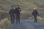
 Increasingly popular walking routes can be followed on an organised basis. Increasingly popular walking routes can be followed on an organised basis.
Walks, varying from one day to one week, are marked out with distinctive pointers.
Detailed charts and information pamphlets are available.
The Burren is a limestone karst region, internationally renowned for its
geological features, archaeological remains and magnificent flora. The Burren
Way never fails to captivate its visitors. The jagged terrain of this uniquely
beautiful part of Ireland and the majestic Cliffs of Moher (views to the Aran
Islands) are two of the delights of this wonderful ramble amongst hills and turloughs.
The Route: Ballyvaughan, Ballinalackan, Doolin, Lahinch.
Distance: 45 km/28 miles.
The Mid Clare Way is a long-distance walking route which makes a circuit of the region
surrounding the county town of Ennis. You will encounter considerable variety in the
landscape and route underfoot- from the Shannon estuary through the fiels of conifers
to the highest point at Ben Dash. There are no major ascents on the route but the landscape
is dotted with many small hills, which the Way climbs through and about. You will encounter
the 'real' Irish rural life of small farms- where every skill is still practised in order
to eke a living from the land. Our ancestors lived here too and there is a dense web of
archaeological sites and history reaching back over the centuries. From round-towers to
Romanesque churches, Norman castles to abbeys, lead mines to limekilns, the diversity in
such a relatively small area is astonishing. The beauty of the Mid Clare Way lies in its
extraordinary diversity and simple charm.
The Route: Newmarket on Fergus, Quin, Clooney, Ballinruan, Doon, Crusheen, Dromore, Ruan,
Dysert O'Dea, Kilnamona, Kilmaley, Connoly, Lisroe, Lanna, Clarecastle.
Distance: 130 km/86 miles.
Lough Derg is one of three major lakes on the River Shannon - Ireland's
longest river. This route follows the river from its mouth in historic Limerick,
past the hydroelectric power station upstream at Ardnacrusha. Then, after the twin
tourist towns of Killaloe/Bliina, the walker is taken on a glorious walk of spectacular
views along the eastern shores of the lake- with many interesting places to take time out.
The Route: Limerick, O'Briens Bridge, Killaloe, Dromineer.
Distance: 64 km/40 miles.
East Clare is a beautiful and hidden corner of the West of Ireland with a landscape
of rugged hills and picturesque valleys intertwined with rivers, lakes, woodlands
and boglands. This is a circular route taking in the Slieve Berngh Mountains, Lough
Graney, the Slieve Aughty Mountains and Lough Derg.
The region has a rich heritage of historic sites, folklore, traditional music, song
and dance, with regular events and festivals.
This is the land of the Great King Brian Boru (his stronghold stands close to Killaloe)
and the great poet and hedge-schoolmaster Brian Merriman, who wrote the epic The Midnight
Court as he sat looking over Lough Graney.
The Route: Killaloe, Broadford, O'Callaghan's Mills, Tulla, Feakle, Flagmount, Whitegate,
Mountshannon, Scarriff.
Distance: 43 km/21 miles.
This route starts at Oughterard and follows the shore of Lough Corrib to Maam.
From Maam it finds a low level way through the great quartzite ranges of the
Maum Turks and Twelve Bens, before descending to the deep, narrow valley of
Killary Harbour and junction with the Western Way (Mayo) near Leenaun.
The Route: Oughterard, Maam, Maameen, Inagh, Toorenacoona, Leenaun.
Distance: 50 km/31 miles.
The Gaeltacht consits of a number of regions in Ireland where Irish is the
predominant language. Bealach na Gaeltachta (Slí Chonamara) is a long-distance
walk which serves the Connemara Gaeltacht. One can immerse oneself in the culture,
landscapes and imagination of one of the most beautiful languages in the world.
The walk extends from Galway city along the shores of Galway Bay through An Spidéal
(Spiddal), An Cheathrú Rua (Carraroe), Ros Muc and Carna, then Northward to
Oughterard and near Recess. The Way stretches over the spectacular landscapes
of Connemara, through hill and bogland to the north, and along the coast to the south.
The Route: Galway city, An Spidéal, An Cheathrú Rua, Ros Muc and Carna, Oughterard, Recess.
Distance: 240 km/150 miles.
 Next Next
|